具体描述
1LOCATION, SIZE, AND EXTENT<br >Situated in northwestern Africa along the Mediterranean Sea,<br >Algeria is the second-largest country on the continent. Compara-<br >tively, it is slightly less than 3.5 times the size of Texas, with a<br >total area of 2,381,740 sq km (919,595 sq mi). Extending about<br >2,400 km (1,500 mi) E-W and 2,100 km (1,300 mi) N-s, Algeria is<br >bounded on the N by the Mediterranean Sea, on the E by Tunisia<br >and Libya, on the SE by Niger, on the sw by Mali, on the w by<br >Mauritania, and on the w and Nw by the Western Sahara and<br >Morocco; the total boundary length is 7,341 km (4,561 mi).<br >Land boundary and claims disputes and claims with Libya and<br >Tunisia were unresolved as of late 1994.<br > Algeria s capital city, Algiers, is located on the northern<br >boundary of the country on the Mediterranean Sea.<br >2TOPOGRAPHY<br >The parallel mountain ranges of the Tell or Maritime Atlas,<br >comprising coastal massifs and northern inland ranges, and the<br >Saharan Atlas divide Algeria into three basic longitudinal zones<br >running generally east-west: the Mediterranean zone or Tell; the<br >High Plateaus, including the regions of Great and Small Kabilia;<br >and the Sahara Desert, accounting for at least 80% of Algeria s<br >total land area. About half of Algeria is 900 m (3,000 ft) or more<br >above sea level, and about 70% of the area is from 760 to 1,680<br >m (2,500 to 5,500 It) in elevation. The highest point is Mount<br >Tahat (2,918 m/9,573 It), in the Ahaggar Range of the Sahara.<br > Only the main rivers of the Tell have water all year round, and<br >even then the summer flow is small. None of the rivers are<br >navigable. The mountainous areas of the High Plateaus are<br >poorly watered; most of the rivers and streams (oueds) flow irreg-<br >ularly, since they depend for water upon an erratic rainfall. In the<br >High Plateaus are many salt marshes and dry or shallow salt lakes<br >(sebkhas or shotts). Farther south, the land becomes increasingly<br >arid, merging into the completely dry desert.<br > Northwestern Algeria is a seismologically active area. Earth-<br >quakes on 10 October 1980 in a rural area southwest of Algiers<br >left over 2,500 persons dead and almost 100,000 homeless.<br >
作者简介
目录信息
读后感
评分
评分
评分
评分
用户评价
打开书本,首先映入眼帘的是清晰而详尽的目录结构,编排的逻辑性极强,让人一眼就能把握住全书的宏观框架。我花费了相当长的时间去研究它的索引系统,发现它摒弃了传统百科全书那种过于僵硬的字母顺序排列,而是采用了更加贴近地理和文化脉络的分类方法,比如将不同区域的国家按照历史上的影响范围进行了归类,这种编排思路极大地提升了信息检索的效率。举个例子,当我试图查找某个与前殖民地历史相关的条目时,我不需要死记硬背每一个国家的具体字母顺序,而是可以直接定位到“西非联盟”或“南部非洲发展共同体”这样的区域性章节下,内容组织紧凑且富有层次感。再者,其内部的交叉引用设计堪称典范,几乎每一个主要条目都会用斜体注明相关联的其他主题,使得读者在阅读过程中能够自然地进行知识的横向延伸,而不是被困在孤立的信息孤岛中。这种精心的结构设计,表明编纂团队对信息流动的理解远超一般水平,确保了即便是初次接触该领域的新读者,也能迅速建立起一个全面而有序的知识网络。
评分在图表和插图的使用方面,这本书展现出了一种克制而高效的美学。它并没有过度依赖那些色彩斑斓但信息密度低的彩图来吸引眼球,而是侧重于功能性极强的黑白地图、流程图和统计图表。我注意到,这些辅助材料的质量非常高,地图的比例尺和图例清晰无比,即便是最微小的地理细节也标注得一丝不苟。特别是那些对比性的数据可视化图表,例如不同国家之间的人均GDP增长趋势对比,它们被设计成简洁的几何图形,能够瞬间将复杂的数据关系直观地传达给读者,省去了大量文字解释的篇幅。这些图表并非简单的装饰品,而是与正文内容紧密结合、互为佐证的核心信息载体。例如,在讨论特定地区的自然资源分布时,附带的等高线图和矿藏分布图的精确度,使得读者可以脱离外部资料,仅凭书中内容就能形成一个立体的空间认知。这种对视觉工具的审慎运用,体现了编者对信息传达效率的极致追求。
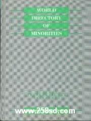
评分这本书的装帧设计着实让人眼前一亮,封面采用了厚实的硬壳纸,触感温润,米白色的底色上,深蓝色的字体和烫金的图案在视觉上形成了沉稳而高雅的对比,散发出一种古典的学术气息。我尤其欣赏它对细节的处理,比如书脊上的微微凸起的纹理,虽然不张扬,但握持时能提供恰到好处的摩擦力,让人感觉到这是一本值得信赖的工具书。内页纸张的选择也极其考究,并非那种廉价的、容易反光的纸张,而是略带哑光的米黄色纸,即便是长时间在灯光下阅读,眼睛也不会感到疲劳,这对于一本百科全书来说至关重要。装订处非常牢固,书页可以平摊得很开,阅读起来毫无压力,这对于查阅特定条目时需要对照多个部分的情况极为方便。不过,如果非要吹毛求疵的话,我个人会更偏爱那种封底设计也能呼应主题,或许可以加入一些非洲大陆的抽象地图线条元素来增加整体的视觉连贯性,但总的来说,仅从物理层面上看,它完全符合一本权威参考资料应有的专业水准和持久耐用的品质要求。它不仅仅是知识的载体,本身也是一件可以放在书架上彰显品位的藏品。
评分这本书的文字风格是其最令人称道的部分之一,它成功地在学术的严谨性和叙述的可读性之间找到了一个绝妙的平衡点。我发现,即便是涉及到复杂的政治经济术语或晦涩难懂的历史事件,作者们也总是能用一种既不失专业性又不至于让非专业人士望而却步的语言来呈现。行文流畅,节奏感把握得非常好,没有那种常见于工具书的生硬和干燥。例如,在描述一个非洲国家的独立进程时,作者不仅列举了关键日期和人物,更巧妙地融入了当时的社会背景和人民的情绪基调,使得枯燥的史实变得鲜活起来,仿佛能感受到那个时代特有的紧张与期盼。尤其赞赏的是,它在引用数据和事实时,总会注明来源的可靠性,这为信息的核实提供了保障,增强了文本的公信力。不同章节的作者群似乎也保持了高度一致的写作标准,语调的统一性令人印象深刻,这在多位专家合作的百科全书中是相当难得的成就,让人感觉全书是一个有机整体,而非零散章节的拼凑。
评分总的来说,这本书给我的感觉是深厚、扎实且极具参考价值,它不是一本用来消遣的读物,而是一把开启特定知识领域的精良钥匙。我特别关注了其中对当代社会热点问题的处理方式,发现在面对一些敏感或快速变化的议题时,它表现出了罕见的审慎和中立。例如,在描述近年来涌现出的跨国合作机制时,它细致地梳理了各方的立场和目标,避免了简单的“好人坏人”标签化处理,而是坚持呈现多维度的利益权衡,这种成熟的叙事态度,在同类参考书中是相当少见的。这本书的价值在于它提供的不仅仅是“是什么”,更重要的是“为什么会是这样”的深度剖析,它要求读者进行思考,而不是被动接受既定事实。读完后我有一种强烈的感受,即掌握了这本书所涵盖的知识体系,就如同获得了一张高质量的、经过多方权威验证的“通行证”,能自信地在相关讨论中发言和探索更深层次的研究课题。
评分 评分 评分 评分 评分相关图书
本站所有内容均为互联网搜索引擎提供的公开搜索信息,本站不存储任何数据与内容,任何内容与数据均与本站无关,如有需要请联系相关搜索引擎包括但不限于百度,google,bing,sogou 等
© 2026 qciss.net All Rights Reserved. 小哈图书下载中心 版权所有


